


Top 100 Coastal Cities Most Exposed to Sea-Level Rise by 2050
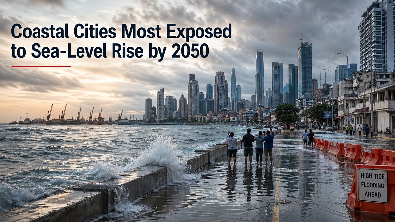
Coastal cities where sea-level rise could put the most people and assets at risk by 2050
This ranking compares major coastal cities by their exposure to sea-level rise, coastal flooding, storm surge, land subsidence and low-elevation urban development by 2050. The score is not a prediction that a city will disappear. It shows where people, infrastructure and valuable urban assets are concentrated in low-lying coastal zones that may face more frequent flooding and higher relative sea levels.
Thank you for reading this post, don't forget to subscribe!The 2050 horizon matters because it sits inside the lifetime of mortgages, ports, airports, metro tunnels, wastewater systems, power assets and long-term urban plans. A city with a high score may still manage the risk through flood barriers, pumps, drainage, zoning, wetland restoration, building standards and subsidence control. A lower-ranked city may still face severe local losses if protection is weak or settlement expands into exposed land.
Last updated: April 25, 2026The upper tier is dominated by dense deltas, subsiding megacities and exposed port hubs
The leading cities share a common pattern: large populations and expensive infrastructure are concentrated in low-lying coastal districts. Many are located in river deltas or estuaries where sea-level rise combines with storm surge, sediment loss, groundwater extraction, land subsidence and rapid urban expansion. Asia-Pacific cities dominate the top of the ranking because many of the world’s largest coastal megacities sit on deltas and reclaimed shorelines.
Jakarta, Indonesia
Jakarta combines land subsidence, low coastal elevation, dense settlement and critical infrastructure exposure. Relative sea-level risk is intensified by sinking land and long-running flood-management challenges.
Bangkok, Thailand
Bangkok’s risk profile reflects the Chao Phraya delta, soft soils, subsidence, high urban density and exposure to tidal and river flooding.
Ho Chi Minh City, Vietnam
The city’s low-lying districts, fast growth and connection to Mekong Delta flood dynamics place large numbers of people and assets in exposed zones.
Manila, Philippines
Manila Bay exposure is amplified by subsidence, storm surge, dense coastal housing and uneven protection across formal and informal settlements.
Shanghai, China
Shanghai sits in the Yangtze Delta with large port, industrial, housing and transport assets concentrated in low-lying coastal and estuarine districts.
Guangzhou, China
Pearl River Delta geography, dense urbanisation and high-value coastal assets make Guangzhou one of the most exposed large cities by 2050.
Mumbai, India
Mumbai’s reclaimed land, monsoon flooding, coastal density and port assets create a strong compound-risk profile.
Kolkata, India
Kolkata’s exposure is shaped by the Ganges-Brahmaputra delta system, riverine flooding, low elevation and major population concentration.
Dhaka, Bangladesh
Dhaka’s huge population density and delta setting increase exposure, even though its coastal risk is mediated by inland river and floodplain dynamics.
Chittagong, Bangladesh
Chittagong’s Bay of Bengal storm-surge exposure, port infrastructure and coastal settlements place it among the highest-risk urban areas.
A high score means high exposure, not unavoidable loss. Strong flood protection, drainage investment, land-use controls, wetland restoration and subsidence management can reduce actual risk. Weak governance or rapid informal expansion can increase it.
Chart: Top 20 coastal cities by 2050 sea-level rise exposure index
The chart highlights how the upper part of the ranking clusters around large Asian delta cities, subsiding coastal megacities and globally important port hubs. The score combines physical exposure and urban concentration. It helps identify broad exposure patterns; it does not replace local engineering studies or official flood-map analysis.
Full ranking table: 100 coastal cities most exposed by 2050
The table applies one consistent method to all 100 cities, so readers can compare broad coastal risk before checking local flood maps, engineering studies or planning documents. The index brings together low-lying urban concentration, projected local sea-level pressure, storm-surge relevance, land subsidence, infrastructure concentration and adaptation capacity.
| Rank | City / Country | Exposure index | Main risk driver |
|---|---|---|---|
| 1 | Jakarta, Indonesia | 98.7 | Land subsidence, low-lying coast, dense urban exposure |
| 2 | Bangkok, Thailand | 97.9 | Chao Phraya delta, subsidence, dense low-lying districts |
| 3 | Ho Chi Minh City, Vietnam | 97.1 | Mekong-linked lowlands, tidal flooding, rapid urban growth |
| 4 | Manila, Philippines | 96.4 | Bay exposure, subsidence, storm surge, dense informal settlements |
| 5 | Shanghai, China | 95.6 | Yangtze delta, major port assets, low-lying reclaimed land |
| 6 | Guangzhou, China | 94.8 | Pearl River Delta exposure, dense assets, storm surge |
| 7 | Mumbai, India | 93.5 | Reclaimed low-lying land, monsoon flooding, dense coastal assets |
| 8 | Kolkata, India | 92.7 | Ganges-Brahmaputra delta setting and large exposed population |
| 9 | Dhaka, Bangladesh | 91.8 | Low-elevation delta exposure and extreme population density |
| 10 | Chittagong, Bangladesh | 90.9 | Bay of Bengal storm surge, port infrastructure, coastal settlements |
| 11 | Lagos, Nigeria | 89.3 | Lagoon coast, rapid growth, drainage stress, asset concentration |
| 12 | Alexandria, Egypt | 88.1 | Nile Delta subsidence, coastal erosion, dense historic core |
| 13 | New Orleans, United States | 86.9 | Below-sea-level districts, subsidence, hurricane surge |
| 14 | Miami, United States | 85.6 | Low elevation, porous limestone, high property exposure |
| 15 | New York City, United States | 84.2 | Harbor assets, subway and tunnel exposure, storm surge |
| 16 | Rotterdam, Netherlands | 82.8 | Low-lying port city with very high defended asset exposure |
| 17 | Amsterdam, Netherlands | 81.7 | Low-lying urban fabric and protected but concentrated assets |
| 18 | Osaka, Japan | 80.5 | Bay-side industrial assets, reclaimed land, typhoon surge |
| 19 | Tokyo, Japan | 79.6 | Tokyo Bay infrastructure, dense coastal wards, typhoon exposure |
| 20 | Tianjin, China | 78.4 | Bohai coastal plain, port assets, subsidence-sensitive land |
| 21 | Nagoya, Japan | 77.2 | Ise Bay storm surge history and industrial waterfront exposure |
| 22 | Shenzhen, China | 76.6 | Pearl River Delta growth corridor and exposed coastal assets |
| 23 | Hong Kong, China | 75.9 | Dense waterfront districts, typhoon surge and critical infrastructure |
| 24 | Xiamen, China | 75.1 | Island-city coastal exposure and typhoon-related flood risk |
| 25 | Ningbo, China | 74.3 | Major port assets on low-lying deltaic coastline |
| 26 | Fuzhou, China | 73.6 | River mouth urbanisation and typhoon surge exposure |
| 27 | Qingdao, China | 72.8 | Port infrastructure and coastal industrial concentration |
| 28 | Dalian, China | 72.1 | Coastal port exposure and strategic transport assets |
| 29 | Busan, South Korea | 71.5 | Major port and low-lying waterfront districts |
| 30 | Incheon, South Korea | 70.8 | Tidal flats, reclaimed land and airport/port exposure |
| 31 | Seoul-Incheon corridor, South Korea | 70.2 | Metropolitan coastal assets around the Yellow Sea |
| 32 | Taipei-New Taipei, Taiwan | 69.4 | River mouth, typhoon rainfall and coastal surge connections |
| 33 | Kaohsiung, Taiwan | 68.8 | Harbor assets, industrial shoreline and typhoon risk |
| 34 | Singapore, Singapore | 68.1 | Low-lying island infrastructure with high adaptation capacity |
| 35 | Penang, Malaysia | 67.4 | Island and mainland coastal urbanisation with storm exposure |
| 36 | Kuala Lumpur-Port Klang, Malaysia | 66.8 | Port Klang coastal assets and low-lying logistics corridors |
| 37 | Surabaya, Indonesia | 66.0 | Deltaic lowlands, subsidence and port-city infrastructure |
| 38 | Semarang, Indonesia | 65.2 | Severe subsidence, tidal flooding and low coastal elevation |
| 39 | Medan-Belawan, Indonesia | 64.6 | Low coastal settlements and port exposure near river mouths |
| 40 | Phnom Penh, Cambodia | 63.9 | Mekong floodplain expansion and drainage constraints |
| 41 | Yangon, Myanmar | 63.1 | Irrawaddy delta setting, cyclone surge and urban growth |
| 42 | Can Tho, Vietnam | 62.4 | Mekong Delta urban exposure and subsidence-sensitive land |
| 43 | Da Nang, Vietnam | 61.6 | Coastal tourism, typhoon surge and river flooding |
| 44 | Haiphong, Vietnam | 60.9 | Red River Delta port assets and low-lying districts |
| 45 | Karachi, Pakistan | 60.1 | Arabian Sea coast, drainage stress and port concentration |
| 46 | Chennai, India | 59.5 | Cyclone exposure, low coastal plains and urban drainage risk |
| 47 | Cochin, India | 58.8 | Backwaters, port assets and low-elevation coastal land |
| 48 | Visakhapatnam, India | 58.0 | Bay of Bengal cyclone surge and industrial shoreline |
| 49 | Colombo, Sri Lanka | 57.3 | Port expansion, low-lying coast and monsoon drainage stress |
| 50 | Malé, Maldives | 56.7 | Very low elevation, limited land reserve and island exposure |
| 51 | Muscat, Oman | 56.0 | Coastal infrastructure in narrow urban corridor |
| 52 | Doha, Qatar | 55.4 | Low coastal development and strategic infrastructure concentration |
| 53 | Dubai, United Arab Emirates | 54.8 | Low-lying waterfront assets and reclaimed coastal development |
| 54 | Abu Dhabi, United Arab Emirates | 54.2 | Island-city assets and coastal infrastructure concentration |
| 55 | Kuwait City, Kuwait | 53.5 | Low coastal plain and Gulf shoreline exposure |
| 56 | Basra, Iraq | 52.9 | Shatt al-Arab lowlands, salinity and flood exposure |
| 57 | Jeddah, Saudi Arabia | 52.3 | Red Sea coastal growth and flood-prone urban drainage |
| 58 | Beirut, Lebanon | 51.7 | Coastal concentration of housing, port and transport assets |
| 59 | Tel Aviv, Israel | 51.1 | Mediterranean coastal assets and dense beachfront development |
| 60 | Istanbul, Turkey | 50.5 | Bosphorus and Marmara waterfront assets |
| 61 | Izmir, Turkey | 49.8 | Bay-side urban concentration and port exposure |
| 62 | Athens-Piraeus, Greece | 49.2 | Critical port assets and dense coastal districts |
| 63 | Venice, Italy | 48.7 | Lagoon exposure, high tides and cultural heritage assets |
| 64 | Trieste, Italy | 48.0 | Adriatic port and waterfront infrastructure |
| 65 | Naples, Italy | 47.5 | Bay-side urban density and coastal transport assets |
| 66 | Barcelona, Spain | 46.9 | Dense Mediterranean waterfront and port assets |
| 67 | Valencia, Spain | 46.2 | Low-lying coastal development and port infrastructure |
| 68 | Lisbon, Portugal | 45.7 | Tagus estuary exposure and strategic waterfront assets |
| 69 | Porto, Portugal | 45.0 | River mouth and Atlantic coastal flood exposure |
| 70 | Marseille, France | 44.5 | Mediterranean port and low waterfront infrastructure |
| 71 | Bordeaux, France | 43.9 | Gironde estuary flood exposure and low-lying districts |
| 72 | Hamburg, Germany | 43.4 | Elbe estuary port assets and storm surge exposure |
| 73 | Bremen-Bremerhaven, Germany | 42.8 | Weser estuary ports and low coastal plains |
| 74 | Copenhagen, Denmark | 42.2 | Low coastal districts and Baltic/North Sea storm risk |
| 75 | Stockholm, Sweden | 41.7 | Archipelago waterfront infrastructure with localized exposure |
| 76 | Helsinki, Finland | 41.2 | Baltic coastal infrastructure and low waterfront districts |
| 77 | London, United Kingdom | 40.8 | Thames estuary assets and tidal flood management dependence |
| 78 | Liverpool, United Kingdom | 40.3 | Mersey waterfront assets and port exposure |
| 79 | Glasgow, United Kingdom | 39.8 | Clyde estuary lowlands and infrastructure concentration |
| 80 | Dublin, Ireland | 39.2 | Low-lying bay districts and coastal transport assets |
| 81 | Cork, Ireland | 38.7 | Tidal river flooding and harbor infrastructure exposure |
| 82 | Boston, United States | 38.2 | Harbor exposure, filled land and high-value infrastructure |
| 83 | San Francisco Bay Area, United States | 37.7 | Bay shoreline assets, airports and low-lying reclaimed land |
| 84 | San Diego, United States | 37.1 | Coastal assets, naval facilities and bluff/shoreline exposure |
| 85 | Los Angeles-Long Beach, United States | 36.6 | Major ports, coastal logistics and dense waterfront assets |
| 86 | Houston-Galveston, United States | 36.0 | Gulf storm surge, petrochemical assets and subsidence |
| 87 | Tampa-St. Petersburg, United States | 35.5 | Low-lying bay shoreline and hurricane surge exposure |
| 88 | Charleston, United States | 35.0 | Tidal flooding, historic lowlands and Atlantic surge |
| 89 | Norfolk-Virginia Beach, United States | 34.4 | Relative sea-level rise, naval assets and storm surge |
| 90 | Washington, D.C., United States | 33.9 | Tidal Potomac exposure and critical federal infrastructure |
| 91 | Vancouver, Canada | 33.4 | Fraser River delta, port assets and low-lying suburbs |
| 92 | Montreal, Canada | 32.8 | Riverine-tidal interaction and waterfront infrastructure |
| 93 | Halifax, Canada | 32.3 | Atlantic harbor exposure and coastal transport assets |
| 94 | Havana, Cuba | 31.8 | Caribbean storm surge and dense coastal development |
| 95 | Santo Domingo, Dominican Republic | 31.2 | Caribbean cyclone surge and river-coast exposure |
| 96 | San Juan, Puerto Rico | 30.7 | Low coastal districts, hurricane surge and critical assets |
| 97 | Port-au-Prince, Haiti | 30.1 | Coastal exposure and limited adaptation capacity |
| 98 | Cartagena, Colombia | 29.6 | Caribbean port, tourism assets and low-lying coast |
| 99 | Guayaquil, Ecuador | 29.1 | Estuary exposure, lowlands and urban expansion |
| 100 | Lima-Callao, Peru | 28.6 | Port assets and coastal infrastructure corridor |
Updated April 25, 2026. City index values are StatRanker estimates, not official city-level figures. The index is compiled from public sea-level projection frameworks, coastal flood screening tools, urban population grids, port-city research and city-level risk characteristics. Use the scores alongside local flood maps and planning documents.
Scatter chart: sea-level pressure versus population and asset exposure
Cities reach high exposure through different pathways. Some combine moderate sea-level pressure with extremely high urban concentration. Others face faster relative sea-level change because land is subsiding. Port hubs can score high because a smaller exposed area contains strategic infrastructure that supports national or global supply chains.
Methodology: how the 2050 sea-level rise exposure index was built
The ranking uses a multi-factor exposure index rather than a single observed measurement. The reason is simple: no official global database publishes a single, regularly updated Top 100 list of coastal cities by 2050 sea-level rise exposure using identical city boundaries, protection assumptions, subsidence estimates, population grids and infrastructure layers. To keep the ranking comparable, each city is assessed across several consistent factors and then converted to a 0–100 index for comparison.
The index weights five main components: people and assets in low-elevation coastal zones (30%); projected local sea-level pressure by 2050 (20%); storm-surge and coastal flood relevance (20%); land subsidence risk (15%); and critical infrastructure concentration, including ports, airports, tunnels, wastewater systems, industrial waterfronts and dense residential districts (15%). Adaptation capacity is treated as a contextual adjustment rather than a direct rank driver, because strong defences can reduce losses but do not erase the concentration of people and assets in flood-prone areas.
The 2050 horizon is used because it is relevant to decisions being made now: infrastructure design, public borrowing, housing finance, insurance, urban zoning, port expansion and transport planning. A mid-century horizon also avoids the larger uncertainty attached to end-of-century projections while still capturing the near-term consequences of sea-level rise, coastal flooding, storm surge and subsidence.
City names are simplified where a wider coastal metro area is more useful than a strict municipal boundary. For that reason, the table uses common urban-area labels such as Los Angeles-Long Beach or San Francisco Bay Area. Index values are rounded to one decimal point. Where values are close, higher population at risk, stronger subsidence relevance and infrastructure concentration determine the order.
The main limitation is that exposure is not the same as vulnerability or expected damage. The index is designed for ranking and comparison, not for predicting exact flood depth, damage cost or annual probability. Real-world outcomes depend on local flood defences, drainage, building codes, emergency planning, insurance systems, land-use controls, wetland buffers, groundwater management and maintenance quality. Elevation models, city boundaries and subsidence estimates vary in quality across countries. For engineering, insurance or property decisions, readers should consult local flood maps and official planning documents.
Key insights from the 2050 coastal city exposure ranking
Asian delta cities dominate the top tier
Large populations, low elevation, rapid urban growth and subsidence place many Asian megacities at the top. The issue is not only ocean rise; it is the collision of sea-level pressure with dense urban expansion in deltas and estuaries.
Subsidence can be as important as sea-level rise
In cities where land is sinking because of groundwater extraction, soil compaction or sediment loss, relative sea-level rise can be much faster than the global mean. Jakarta, Bangkok, Manila and Semarang illustrate this compound risk.
Wealthy cities still carry large exposed assets
New York, Miami, Rotterdam, Amsterdam, Tokyo and Osaka have stronger financial and engineering capacity than many lower-income cities. They still rank high because waterfront assets, ports, tunnels and business districts are extremely concentrated.
Ports turn local flooding into supply-chain risk
Port cities matter beyond their residents. Flooding in a major logistics hub can disrupt energy systems, shipping routes, manufacturing inputs, food movement and insurance markets far outside the flood zone itself.
The most important takeaway is concentration. A small number of coastal megacities and port hubs hold a very large share of the world’s people, infrastructure and economic assets in flood-prone coastal districts. Adaptation choices made in those places will shape mid-century urban resilience.
What this means for residents, investors and city planners
For residents, the ranking is a prompt to look below the city name. Risk varies sharply within a single metropolitan area. A higher, inland neighbourhood may face little direct coastal flooding while a waterfront district, reclaimed island, port zone or low-lying informal settlement faces repeated disruption. Housing decisions should consider elevation, drainage, insurance availability, evacuation routes and local flood-history records.
For investors and businesses, sea-level exposure affects more than beachfront property. Warehouses, container terminals, airports, power substations, data centres, wastewater plants, road tunnels and metro systems can become costlier to insure, maintain or finance. A city with strong adaptation planning may remain attractive, while a city without credible flood-management investment can face rising long-term risk premiums.
For city planners, the ranking underlines the need to combine hard infrastructure with smarter land use. Sea walls, dikes and pumps can be essential, but they work best when paired with wetlands, mangroves, setback rules, elevated buildings, drainage upgrades, groundwater controls and transparent risk communication. The goal is not to abandon every coastal city; it is to stop adding new vulnerability in places already exposed.
FAQ: understanding sea-level rise exposure
Does a high ranking mean the city will be underwater by 2050?
No. A high ranking means that people, assets or infrastructure are highly exposed to sea-level rise and coastal flooding. It does not mean the entire city will be permanently underwater. Protection, drainage, zoning and adaptation investment can materially change outcomes.
Why are so many Asian cities near the top?
Many Asian megacities sit in large river deltas or low coastal plains. They often combine rapid urban growth, dense settlement, port infrastructure, monsoon or cyclone exposure and land subsidence. That creates compound risk by 2050.
What is the difference between sea-level rise and coastal flooding?
Sea-level rise is the long-term increase in average sea level. Coastal flooding happens when tides, storm surge, waves, heavy rainfall and drainage failure push water into urban areas. Rising seas make many flooding events more frequent and more damaging.
Why does land subsidence matter so much?
If land is sinking while the ocean is rising, local relative sea-level rise becomes faster. In some deltas and coastal megacities, groundwater extraction and soil compaction can be as important as global sea-level rise for near-term flood risk.
Are rich coastal cities safer?
They often have better adaptation capacity, stronger engineering systems and more public finance. But they may also concentrate enormous value in waterfront districts, ports, transit tunnels and utility networks. High protection does not mean zero exposure.
Why use 2050 instead of 2100?
2050 is close enough to influence today’s mortgages, infrastructure plans, insurance decisions and public budgets. It also carries less uncertainty than end-of-century projections while still showing clear sea-level and flooding consequences.
Can a city reduce its future risk?
Yes. Cities can reduce actual damage through flood barriers, pumps, nature-based buffers, mangrove restoration, stricter zoning, elevated buildings, early-warning systems, better drainage and policies that slow land subsidence.
Why do different sea-level maps disagree?
They use different elevation models, scenarios, flood assumptions, city boundaries, tide levels, treatment of coastal defences and population grids. That is why a global ranking should be read as a screening tool, not as a site-level flood certificate.
Sources
-
NASA Sea Level Change Portal — IPCC AR6 Sea Level Projection Tool.
Used for the scientific basis of regional sea-level projections and scenario framing.
https://sealevel.nasa.gov/data_tools/17/ -
IPCC Sixth Assessment Report, Working Group II, Chapter 6: Cities, settlements and key infrastructure.
Used for the relationship between urbanisation, coastal flooding, infrastructure exposure and adaptation capacity.
https://www.ipcc.ch/report/ar6/wg2/chapter/chapter-6/ -
Climate Central Coastal Risk Screening Tool.
Used as a global coastal flood and sea-level rise screening reference, especially for low-elevation exposure.
https://coastal.climatecentral.org/ -
NOAA Sea Level Rise Viewer.
Used for U.S. coastal flood and sea-level rise mapping context, including community-level impacts and mapping confidence.
https://coast.noaa.gov/slr/ -
OECD Environment Working Paper: Ranking Port Cities with High Exposure and Vulnerability to Climate Extremes.
Used as a methodological reference for population and asset exposure in large port cities.
https://www.oecd.org/en/publications/ranking-port-cities-with-high-exposure-and-vulnerability-to-climate-extremes_011766488208.html -
WorldPop gridded population estimate datasets.
Used as a reference for population-grid logic and the importance of aggregating population estimates to custom exposure areas.
https://www.worldpop.org/methods/populations -
GHSL / European Commission Joint Research Centre.
Used as a reference for harmonised urban-centre and settlement-layer approaches in global city comparison.
https://human-settlement.emergency.copernicus.eu/
StatRanker (Website)
administrator