


Top 98 Cities by Green Space per Capita in 2025
Green Space per Capita by City 2025: Estimated 98-City Ranking
Data snapshot: 2025 harmonised comparable release · Page checked: April 11, 2026 · Coverage: 98 directly comparable cities · Unit: square metres per resident (m²/person)
Thank you for reading this post, don't forget to subscribe!Green space per capita by city measures how many square metres of selected vegetated urban land are available per resident inside a standardised city boundary. In this 2025 derived snapshot, green land means selected vegetated land-cover classes inside the harmonised urban footprint, not only formal public parks.
Answer: Canberra ranks first in this estimated green space per capita by city 2025 snapshot, with 420 m²/person. Wellington, Ottawa, Helsinki and Oslo complete the top five. The full table contains 98 directly comparable cities, not a Top 100 list.
Continue exploring
More StatRanker pages connected by topic, category or ranking theme.
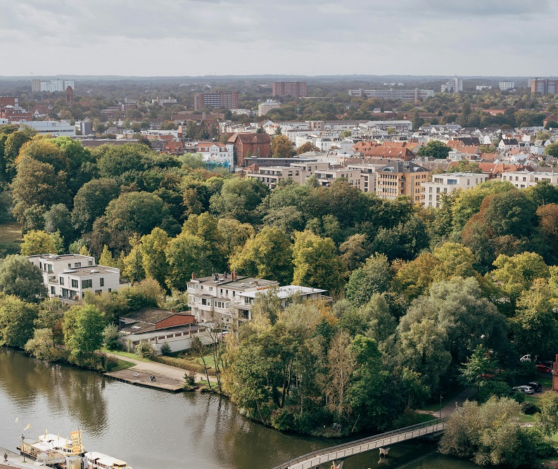
Top 100 Cities by Green Space per Person, 2026
Open rankingThis indicator matters because it links land use, public health, heat resilience, biodiversity, housing pressure, and long-term planning choices. A city with more green space per resident usually has more room for cooling, recreation, stormwater absorption, and everyday environmental comfort. A city with less may still be attractive and productive, but green space per resident shrinks as more people share a smaller green base.
The comparable snapshot contains 98 city entries measured under the same boundary, population and land-cover rules.
Green space per capita by city 2025: top-ranking cities
The highest-ranked cities are not the biggest megacities. They are mostly medium-sized cities or capitals with one or more structural advantages: extensive protected land inside the urban footprint, relatively moderate density, strong planning traditions, or geography that leaves large vegetated areas within city boundaries. Canberra, Wellington, Ottawa, Helsinki and Oslo rank highly because they pair large green systems with population scales that do not compress the ratio as severely.
The top 20 within the 98-city snapshot is concentrated in Europe, North America and Asia-Pacific. Europe contributes a large share of the upper tier, while Canada and Australia appear repeatedly because their urban footprints often retain substantial land for parks, woodland, or lower-density green corridors. These values measure green land per resident within the harmonised boundary; they do not rank every urban outcome.
| Rank | City | Country | Green space per capita |
|---|---|---|---|
| 1 | Canberra | Australia | 420 m²/person |
| 2 | Wellington | New Zealand | 380 m²/person |
| 3 | Ottawa | Canada | 360 m²/person |
| 4 | Helsinki | Finland | 340 m²/person |
| 5 | Oslo | Norway | 330 m²/person |
| 6 | Stockholm | Sweden | 320 m²/person |
| 7 | Tallinn | Estonia | 300 m²/person |
| 8 | Ljubljana | Slovenia | 290 m²/person |
| 9 | Vienna | Austria | 275 m²/person |
| 10 | Vancouver | Canada | 270 m²/person |
Chart 1. Top 20 cities by green space per capita in the 98-city snapshot
The largest gap appears near the top of the chart. Below the first few leaders, the ranking becomes denser, so smaller differences in m²/person can change a city’s position.
Green space per capita by city 2025 table: 98 comparable cities
The table below contains the full 98-city comparable snapshot used for this ranking. Values are rounded estimates in square metres of selected vegetated land per resident.
| Rank | City | Country | Green space per capita |
|---|---|---|---|
| 1 | Canberra | Australia | 420 m²/person |
| 2 | Wellington | New Zealand | 380 m²/person |
| 3 | Ottawa | Canada | 360 m²/person |
| 4 | Helsinki | Finland | 340 m²/person |
| 5 | Oslo | Norway | 330 m²/person |
| 6 | Stockholm | Sweden | 320 m²/person |
| 7 | Tallinn | Estonia | 300 m²/person |
| 8 | Ljubljana | Slovenia | 290 m²/person |
| 9 | Vienna | Austria | 275 m²/person |
| 10 | Vancouver | Canada | 270 m²/person |
| 11 | Zurich | Switzerland | 260 m²/person |
| 12 | Calgary | Canada | 255 m²/person |
| 13 | Edmonton | Canada | 250 m²/person |
| 14 | Munich | Germany | 245 m²/person |
| 15 | Copenhagen | Denmark | 240 m²/person |
| 16 | Portland | United States | 235 m²/person |
| 17 | Seattle | United States | 230 m²/person |
| 18 | Melbourne | Australia | 225 m²/person |
| 19 | Sydney | Australia | 220 m²/person |
| 20 | Auckland | New Zealand | 215 m²/person |
| 21 | Brisbane | Australia | 210 m²/person |
| 22 | Adelaide | Australia | 205 m²/person |
| 23 | Perth | Australia | 200 m²/person |
| 24 | Reykjavik | Iceland | 198 m²/person |
| 25 | Prague | Czechia | 195 m²/person |
| 26 | Berlin | Germany | 190 m²/person |
| 27 | Amsterdam | Netherlands | 185 m²/person |
| 28 | Luxembourg City | Luxembourg | 182 m²/person |
| 29 | Dublin | Ireland | 180 m²/person |
| 30 | Edinburgh | United Kingdom | 178 m²/person |
| 31 | Glasgow | United Kingdom | 176 m²/person |
| 32 | Vitoria-Gasteiz | Spain | 175 m²/person |
| 33 | Lisbon | Portugal | 174 m²/person |
| 34 | Madrid | Spain | 172 m²/person |
| 35 | Barcelona | Spain | 170 m²/person |
| 36 | Rome | Italy | 168 m²/person |
| 37 | Paris | France | 164 m²/person |
| 38 | London | United Kingdom | 162 m²/person |
| 39 | Brussels | Belgium | 160 m²/person |
| 40 | Warsaw | Poland | 158 m²/person |
| 41 | Budapest | Hungary | 156 m²/person |
| 42 | Athens | Greece | 154 m²/person |
| 43 | Bucharest | Romania | 150 m²/person |
| 44 | Singapore | Singapore | 145 m²/person |
| 45 | Seoul | South Korea | 140 m²/person |
| 46 | Hobart | Australia | 134 m²/person |
| 47 | Christchurch | New Zealand | 132 m²/person |
| 48 | Quebec City | Canada | 130 m²/person |
| 49 | Montreal | Canada | 128 m²/person |
| 50 | Toronto | Canada | 126 m²/person |
| 51 | Hangzhou | China | 125 m²/person |
| 52 | New York City | United States | 124 m²/person |
| 53 | Chicago | United States | 122 m²/person |
| 54 | Tokyo | Japan | 120 m²/person |
| 55 | San Francisco | United States | 120 m²/person |
| 56 | Los Angeles | United States | 118 m²/person |
| 57 | Denver | United States | 116 m²/person |
| 58 | Taipei | Taiwan | 115 m²/person |
| 59 | Minneapolis | United States | 114 m²/person |
| 60 | Washington, D.C. | United States | 112 m²/person |
| 61 | Hong Kong | China (Hong Kong SAR) | 110 m²/person |
| 62 | Boston | United States | 110 m²/person |
| 63 | Atlanta | United States | 108 m²/person |
| 64 | Austin | United States | 106 m²/person |
| 65 | Shenzhen | China | 105 m²/person |
| 66 | Mexico City | Mexico | 104 m²/person |
| 67 | Bogotá | Colombia | 98 m²/person |
| 68 | Lima | Peru | 94 m²/person |
| 69 | Santiago | Chile | 92 m²/person |
| 70 | Buenos Aires | Argentina | 90 m²/person |
| 71 | Montevideo | Uruguay | 88 m²/person |
| 72 | São Paulo | Brazil | 86 m²/person |
| 73 | Kuala Lumpur | Malaysia | 85 m²/person |
| 74 | Rio de Janeiro | Brazil | 84 m²/person |
| 75 | Curitiba | Brazil | 82 m²/person |
| 76 | Brasília | Brazil | 80 m²/person |
| 77 | Hanoi | Vietnam | 80 m²/person |
| 78 | Quito | Ecuador | 78 m²/person |
| 79 | La Paz | Bolivia | 76 m²/person |
| 80 | Bangkok | Thailand | 75 m²/person |
| 81 | Panama City | Panama | 74 m²/person |
| 82 | San José | Costa Rica | 72 m²/person |
| 83 | Havana | Cuba | 70 m²/person |
| 84 | Kingston | Jamaica | 68 m²/person |
| 85 | Cape Town | South Africa | 66 m²/person |
| 86 | Johannesburg | South Africa | 64 m²/person |
| 87 | Nairobi | Kenya | 62 m²/person |
| 88 | Kigali | Rwanda | 60 m²/person |
| 89 | Addis Ababa | Ethiopia | 58 m²/person |
| 90 | Accra | Ghana | 56 m²/person |
| 91 | Casablanca | Morocco | 55 m²/person |
| 92 | Rabat | Morocco | 54 m²/person |
| 93 | Cairo | Egypt | 53 m²/person |
| 94 | Amman | Jordan | 52 m²/person |
| 95 | Dubai | United Arab Emirates | 51 m²/person |
| 96 | Doha | Qatar | 50 m²/person |
| 97 | Istanbul | Turkey | 49 m²/person |
| 98 | Tel Aviv | Israel | 48 m²/person |
Table logic: the values shown here are derived estimates. Formula: selected vegetated land area inside the harmonised urban-centre boundary divided by resident population inside the same boundary. Values are rounded to whole m²/person. Data snapshot: 2025 harmonised comparable release; page checked: April 11, 2026.
Methodology: how green space per capita by city is estimated
Green space per capita is calculated as selected vegetated land area divided by resident population inside a harmonised city boundary. The calculation used here is: selected green land area within the urban-centre boundary / resident population within the same boundary = m²/person. A standardised boundary and consistent land-cover base are used because municipal park statistics often apply different definitions across cities.
The boundary layer follows harmonised urban-centre delineations. Green land is derived from internationally comparable land-cover layers by selecting vegetated classes inside those boundaries. The vegetated class rule treats tree cover, shrubland, grassland, wetland vegetation, mangroves, moss/lichen vegetation and comparable urban vegetation as green land where those classes fall inside the harmonised urban footprint. Built-up land, bare or sparse vegetation, permanent water, snow and ice are not counted as green space in this derived estimate.
The “2025” label refers to the latest available harmonised data snapshot, not to a same-year ground survey across every city. The datasets used here were released or updated in 2024–2025, while some underlying land-cover layers refer to benchmark years such as 2020 or 2021. Global land-cover products and urban-boundary systems are published with a lag because they require validation and harmonisation.
The figures are derived from the boundary, land-cover and population workflow described above; they are not a single official published city ranking. Values are rounded to whole m²/person. Green space per capita is a stock measure: it does not directly show whether green areas are evenly distributed across neighbourhoods, publicly accessible, or reachable within a short walk.
Insights from the green space per capita by city ranking
The distribution is wide rather than tightly clustered. Canberra leads, while the 98-city comparable snapshot has a mean of 150.4 m²/person and a median of 127 m²/person. That gap shows that a relatively small group of very green cities pulls the mean upward, creating a clear upper tail rather than a smooth, even spread.
Europe supplies the largest number of cities in the current snapshot, and many sit in the upper-middle band rather than only at the absolute top. That suggests a broader planning tradition in which meaningful green space is preserved across a wider share of cities. North America and Asia-Pacific also place strongly, but with sharper contrasts between very green cities and denser metropolitan systems further down the list.
Latin American cities form an important middle band. Their values are below the top European and Australasian leaders, but many still sit well above the lower tail. Africa and MENA appear lower in this snapshot, but dry-climate environments, compressed urban growth and different land-cover conditions all affect the headline result. Arid-region vegetation measures may also understate usable public open space where plazas, shaded streets or non-vegetated public spaces matter locally.
Chart 2. Distribution of the 98-city comparable snapshot
The 98-city snapshot is not concentrated in a single narrow band. Bin counts are computed from the table values; bin limits are inclusive as labelled. The distribution contains a lower cluster, a substantial middle and a high-green-space tail above 200 m²/person.
What green space per capita means for residents, planning and investment
This indicator helps explain why two cities with similar incomes can feel different in summer heat, daily recreation and neighbourhood comfort. More green space per resident often means better potential for shade, less hard-surface heat build-up, more room for walking and stronger buffering during heavy rain.
For families, the metric adds context on everyday liveability. For migrants and remote workers, it adds information that GDP and wages do not capture. For property buyers and investors, it signals land-use pressure and planning trade-offs. Cities that preserve a strong green base usually reflect long-term decisions about which land remains open instead of being fully converted into buildable use.
For policymakers and local administrations, the core issue is balance. High density is not automatically bad, and low density is not automatically good. A city can grow, add housing and preserve green space when land strategy protects enough open vegetated area. If population rises faster than protected green area, per-capita availability falls even when new parks are added.
FAQ about green space per capita by city
Which city has the most green space per capita in this 2025 snapshot?
Canberra ranks first in this estimated 98-city snapshot, with 420 m² of selected green land per resident inside the harmonised urban footprint.
Why are Canberra and Wellington so high?
They combine large green land areas inside the urban footprint with population sizes that do not compress the ratio as severely as in very large megacities. Geography and planning both matter.
Does more green space per capita mean everyone has good access to parks?
No. A city can score well on per-capita green land and still have neighbourhood inequality in access. The metric is about total green area per resident, not the walking distance from each home to usable public greenery.
Why can a rich, dense city rank lower than a smaller capital?
Because this indicator is driven by land and population at the same time. If the resident count grows faster than preserved green area, the ratio falls. Higher income does not change that land constraint.
Is this the same as “public parks per person”?
Not exactly. In a harmonised cross-city approach, green space usually refers to broader vegetated land cover inside a standardised urban boundary, not only municipally administered parks.
Can a city improve its rank quickly?
Large jumps are uncommon because urban land is already heavily contested. Cities can improve over time through green belts, river restoration, urban forests and stronger land-use protection, but the largest gains usually take years.
Why is this still useful if the underlying land-cover year is earlier than 2025?
Global city comparisons depend on validated, harmonised datasets that are published with a lag. A consistent benchmark is preferable to combining local claims that use different boundaries, methods and definitions.
Official sources for boundaries, land-cover inputs and indicator context
-
Derived calculation used for this ranking
Green space per capita = selected vegetated land area inside the harmonised urban-centre boundary / resident population inside the same boundary. The calculation uses the boundary and land-cover sources listed below and rounds results to whole m²/person. The result is a derived estimate, not a single official published ranking table.
-
GHSL Urban Centre Database (GHS-UCDB R2024A / 2025 release context)
Standardised urban-centre boundaries and city attributes used here to keep cross-city comparisons consistent.
https://human-settlement.emergency.copernicus.eu/ghs_ucdb_2024.php -
JRC publication: Stats in the City – the GHSL Urban Centre Database 2025
Technical documentation for the public release and for the logic of harmonised urban-centre reporting used in this page.
https://publications.jrc.ec.europa.eu/repository/handle/JRC139768 -
ESA WorldCover
Global land-cover mapping used as a consistent base for identifying vegetated classes across cities at fine spatial resolution.
https://worldcover2021.esa.int/download -
Copernicus Global Dynamic Land Cover / LCFM
Official land-cover service used as a methodological reference for consistent interpretation of green land classes across places.
https://land.copernicus.eu/en/products/global-dynamic-land-cover -
UN-Habitat Urban Indicators Database – Open spaces and green areas
International indicator context for green area per capita and related urban-space measures; used as methodological context, not as the direct source of the 98 table values.
https://data.unhabitat.org/pages/open-spaces-and-green-areas -
OECD Local Data Portal – Methodology and sources
Cross-check showing that green area per capita is also treated as a recognised urban indicator in comparative city statistics frameworks.
https://localdataportal.oecd.org/methodology.html
Related rankings
More StatRanker pages connected by topic, category or ranking theme.
Top 100 Cities by Green Space per Person, 2026
Open rankingStatRanker (Website)
administrator