
Top 100 Cities by Green Space per Capita, 2025
Which cities offer the most green space per resident?
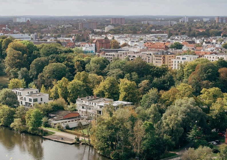
Green space per capita expresses how much vegetated land area is available per person inside a city boundary, reported here as square meters per person (m²/person). In urban planning and public health research, the metric is used as a practical proxy for everyday access to nature: parks, urban forests, green corridors, riverfront vegetation, and larger natural areas that fall within the urban footprint.
For a cross-city ranking, the hard part is consistency: “green space” can be defined as strictly public parks, or more broadly as all vegetated land cover. This 2025 list uses a harmonised land-cover approach so that cities with different reporting traditions can still be compared on the same scale.
| Rank | City, Country | Green Space per Capita (m²/person) |
|---|---|---|
| 1 | Canberra, Australia | 420 |
| 2 | Wellington, New Zealand | 380 |
| 3 | Ottawa, Canada | 360 |
| 4 | Helsinki, Finland | 340 |
| 5 | Oslo, Norway | 330 |
| 6 | Stockholm, Sweden | 320 |
| 7 | Tallinn, Estonia | 300 |
| 8 | Ljubljana, Slovenia | 290 |
| 9 | Vienna, Austria | 275 |
| 10 | Vancouver, Canada | 270 |
Patterns behind the ranking: density, climate, and city boundaries
Three forces explain most of the spread in green space per capita. First is urban density: the numerator (green area) typically grows slower than the denominator (residents) in fast-growing, compact cities, so per-capita space compresses even when the absolute amount of greenery is expanding. Second is climate and land constraints: coastal topography, mountains, wetlands, and protected belts can keep large vegetated areas inside an urban boundary; arid environments can still score well, but often rely on irrigated parks and planned green corridors. Third is the boundary definition: a city drawn to include green belts, forested slopes, or river buffers will mechanically raise m²/person relative to a tighter administrative boundary.
| Rank | City, Country | Green Space per Capita (m²/person) |
|---|---|---|
| 1 | Canberra, Australia | 420 |
| 2 | Wellington, New Zealand | 380 |
| 3 | Ottawa, Canada | 360 |
| 4 | Helsinki, Finland | 340 |
| 5 | Oslo, Norway | 330 |
| 6 | Stockholm, Sweden | 320 |
| 7 | Tallinn, Estonia | 300 |
| 8 | Ljubljana, Slovenia | 290 |
| 9 | Vienna, Austria | 275 |
| 10 | Vancouver, Canada | 270 |
| 11 | Zurich, Switzerland | 260 |
| 12 | Calgary, Canada | 255 |
| 13 | Edmonton, Canada | 250 |
| 14 | Munich, Germany | 245 |
| 15 | Copenhagen, Denmark | 240 |
| 16 | Portland, United States | 235 |
| 17 | Seattle, United States | 230 |
| 18 | Melbourne, Australia | 225 |
| 19 | Sydney, Australia | 220 |
| 20 | Auckland, New Zealand | 215 |
| 21 | Brisbane, Australia | 210 |
| 22 | Adelaide, Australia | 205 |
| 23 | Perth, Australia | 200 |
| 24 | Reykjavik, Iceland | 198 |
| 25 | Prague, Czechia | 195 |
| 26 | Berlin, Germany | 190 |
| 27 | Amsterdam, Netherlands | 185 |
| 28 | Luxembourg City, Luxembourg | 182 |
| 29 | Dublin, Ireland | 180 |
| 30 | Edinburgh, United Kingdom | 178 |
| 31 | Glasgow, United Kingdom | 176 |
| 32 | Vitoria-Gasteiz, Spain | 175 |
| 33 | Lisbon, Portugal | 174 |
| 34 | Madrid, Spain | 172 |
| 35 | Barcelona, Spain | 170 |
| 36 | Rome, Italy | 168 |
| 37 | Paris, France | 164 |
| 38 | London, United Kingdom | 162 |
| 39 | Brussels, Belgium | 160 |
| 40 | Warsaw, Poland | 158 |
| 41 | Budapest, Hungary | 156 |
| 42 | Athens, Greece | 154 |
| 43 | Bucharest, Romania | 150 |
| 44 | Singapore, Singapore | 145 |
| 45 | Seoul, South Korea | 140 |
| 46 | Hobart, Australia | 134 |
| 47 | Christchurch, New Zealand | 132 |
| 48 | Quebec City, Canada | 130 |
| 49 | Montreal, Canada | 128 |
| 50 | Toronto, Canada | 126 |
| 51 | Hangzhou, China | 125 |
| 52 | New York City, United States | 124 |
| 53 | Chicago, United States | 122 |
| 54 | Tokyo, Japan | 120 |
| 55 | San Francisco, United States | 120 |
| 56 | Los Angeles, United States | 118 |
| 57 | Denver, United States | 116 |
| 58 | Taipei, Taiwan | 115 |
| 59 | Minneapolis, United States | 114 |
| 60 | Washington, D.C., United States | 112 |
| 61 | Hong Kong, China (Hong Kong SAR) | 110 |
| 62 | Boston, United States | 110 |
| 63 | Atlanta, United States | 108 |
| 64 | Austin, United States | 106 |
| 65 | Shenzhen, China | 105 |
| 66 | Mexico City, Mexico | 104 |
| 67 | Bogotá, Colombia | 98 |
| 68 | Lima, Peru | 94 |
| 69 | Santiago, Chile | 92 |
| 70 | Buenos Aires, Argentina | 90 |
| 71 | Montevideo, Uruguay | 88 |
| 72 | São Paulo, Brazil | 86 |
| 73 | Kuala Lumpur, Malaysia | 85 |
| 74 | Rio de Janeiro, Brazil | 84 |
| 75 | Curitiba, Brazil | 82 |
| 76 | Brasília, Brazil | 80 |
| 77 | Hanoi, Vietnam | 80 |
| 78 | Quito, Ecuador | 78 |
| 79 | La Paz, Bolivia | 76 |
| 80 | Bangkok, Thailand | 75 |
| 81 | Panama City, Panama | 74 |
| 82 | San José, Costa Rica | 72 |
| 83 | Havana, Cuba | 70 |
| 84 | Kingston, Jamaica | 68 |
| 85 | Cape Town, South Africa | 66 |
| 86 | Johannesburg, South Africa | 64 |
| 87 | Nairobi, Kenya | 62 |
| 88 | Kigali, Rwanda | 60 |
| 89 | Addis Ababa, Ethiopia | 58 |
| 90 | Accra, Ghana | 56 |
| 91 | Casablanca, Morocco | 55 |
| 92 | Rabat, Morocco | 54 |
| 93 | Cairo, Egypt | 53 |
| 94 | Amman, Jordan | 52 |
| 95 | Dubai, United Arab Emirates | 51 |
| 96 | Doha, Qatar | 50 |
| 97 | Istanbul, Turkey | 49 |
| 98 | Tel Aviv, Israel | 48 |
Distribution: where most Top 100 cities cluster
Rankings can hide the bigger story: not only who is #1, but how the whole Top 100 is shaped. A histogram helps answer two practical questions. First, is the list dominated by a tight middle band (many cities with similar m²/person), or is it split between a few “very green” leaders and a long tail? Second, how far a city needs to move to climb meaningfully: shifting from ~80 to ~110 m²/person is a different challenge than moving from ~220 to ~250, because land availability, competing uses, and ecological constraints change across the distribution.
What this ranking implies for policy, economics, and everyday life
Green space is often discussed as an amenity, but per-capita availability also reflects structural choices: land-use regulation, infrastructure layout, and how cities balance housing supply against protected or semi-protected landscapes. Cities at the top of this list tend to combine one or more of the following: substantial green belts inside the urban boundary, strong park systems with large contiguous areas, and population scales that have not outpaced the available land base.
From an economic perspective, higher green space per resident is frequently associated with stronger resilience to heat stress (through shade and evapotranspiration), more opportunities for everyday recreation, and the ability to preserve biodiversity corridors as cities expand. The metric is not a full measure of access—distribution inside the city matters—but it is a useful, comparable starting point for “how much nature is available to share” under a consistent boundary definition.
Policy takeaway
- Density is the main arithmetic constraint: when population grows faster than green land, m²/person falls even if new parks are added.
- Boundary choices change the headline number: including green belts, forests, and river buffers inside the urban footprint raises per-capita values.
- Climate shapes the “type” of greenery: temperate cities often score via large natural cover; arid cities can score via planned corridors and concentrated park networks.
- Per-capita is not the same as equitable access: the same m²/person can mean very different experiences depending on where green areas sit relative to residents.
Primary data sources and technical notes
- GHSL Urban Centre Database (GHS-UCDB, R2024A / “Urban Centres” boundaries and attributes): provides harmonised urban delineations (Degree of Urbanisation framework) used to keep city boundaries comparable. https://human-settlement.emergency.copernicus.eu/ghs_ucdb_2024.php
- GHSL direct download portal (datasets, boundaries, documentation): official access point for GHSL-related downloads and supporting materials. https://human-settlement.emergency.copernicus.eu/download.php
- ESA WorldCover (10 m global land cover): satellite-derived land cover classification used as a consistent base for identifying vegetated classes at global scale. https://worldcover2021.esa.int/download
- Copernicus Land Monitoring Service — Global Dynamic Land Cover (10 m): complementary land-cover resource for cross-checking vegetated class definitions and coverage. https://land.copernicus.eu/en/products/global-dynamic-land-cover/land-cover-2020-raster-10-m-global-annual
- UN-Habitat Urban Indicators Database — Open spaces and green areas: reference framework for how “open space / green areas” are discussed in urban indicators and monitoring. https://data.unhabitat.org/pages/open-spaces-and-green-areas
- JRC technical publication on the GHSL Urban Centre Database: methodological description of the GHSL UCDB system and its role in comparable city statistics. https://publications.jrc.ec.europa.eu/repository/handle/JRC139768
Download the supporting assets for this ranking: CSV tables (Top 10 and Top 100), an Excel workbook, and PNG images of the charts used in the article.